Listeners:
Top listeners:
-
 play_arrow
WBPL – LIVE As Blackpool As You Are
 Adele - Easy On Me
Wow I love this song! Thank you for your amazing music!
Aria R.
Adele - Easy On Me
Wow I love this song! Thank you for your amazing music!
Aria R.
 Deep Purple - Smoke On the Water
Shoutout to the rainbow in my life, Gina!
Orion S.
Deep Purple - Smoke On the Water
Shoutout to the rainbow in my life, Gina!
Orion S.
 Luna Park - Space Melody (Radio Version)
Calling my cosmic companion, Jane! Hit play and let's embark on a musical space journey.
Luna Park - Space Melody (Radio Version)
Calling my cosmic companion, Jane! Hit play and let's embark on a musical space journey.

Thunderstorms may cause travel disruption in England and Wales Met Office

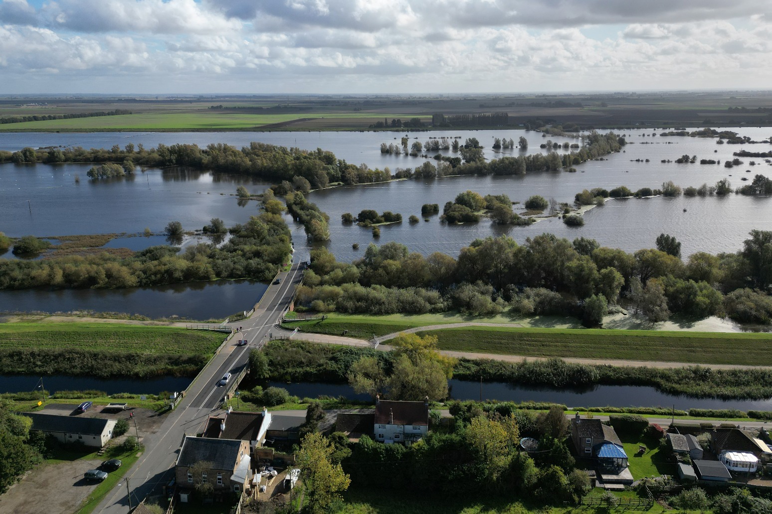
Thunderstorms and heavy rain may cause travel disruption across parts of southern England and Wales, the Met Office has warned.
The weather service has issued a yellow thunderstorm warning from 4pm to 11.59pm on Monday across much of South Wales, South West England, and parts of southern England.
The Met Office said there was a “good chance” that driving conditions will be affected by spray, standing water or hail, adding that delays to train services are possible.
It said that flooding of a few homes and businesses was also possible, with damage to buildings and structures from lightning strikes, hail or gusty winds most likely close to coasts.
Frank Saunders, a chief meteorologist at the Met Office, said: “Areas of heavy showers and thunderstorms will move northwards across southern parts of England and Wales later this afternoon before clearing northwards overnight.
“It’s possible that some places could see 20-30mm of rain within two to three hours, with a small chance that a few places could receive 40mm.
“Thunderstorms are most likely for south-facing coastal districts, and hail and some strong gusts of wind could accompany the heaviest showers and thunderstorms.”
Further heavy showers and thunderstorms are expected across central and southern areas of the UK on Tuesday.
A longer period of heavy rain is also expected over parts of south-east Scotland and north-east England later on Tuesday through to Wednesday.
The Met Office said further weather warnings were possible until midweek as rain falls on already wet ground, but added that the risk of flooding should reduce.
The weather service said it also had “increasing confidence” that ex-Hurricane Kirk will track to the south of the UK, bringing heavy rains and strong winds to northern France.
Although north and south shifts remain possible, the threat of significant impacts to the UK from the ex-hurricane are now much reduced, it added.
The Met Office said temperatures would decrease from Wednesday in the north, with all areas experiencing below average temperatures from Thursday.
Night frosts are also expected for some regions later in the week, and snow is possible for the higher mountains of Scotland.
Published: by Radio NewsHub


Chart
-

1
Jonas Blue, Liam Payne And Lennon Stella
-

2
Tanja Thomas
-
3
The Monkees, 01.01
-
Top popular

Difficult day as last blast furnace shuts down at Port Talbot steelworks

UK Government charters flight for Britons in Lebanon

Household energy bills to rise for winter as Ofgem lifts price cap

Downton Abbey creator Julian Fellowes Dame Maggie Smith was blessing in my life

Ringleader of plot to smuggle 76m of cocaine into UK hidden in bananas jailed