Listeners:
Top listeners:
-
 play_arrow
WBPL – LIVE As Blackpool As You Are
 Adele - Easy On Me
Wow I love this song! Thank you for your amazing music!
Aria R.
Adele - Easy On Me
Wow I love this song! Thank you for your amazing music!
Aria R.
 Deep Purple - Smoke On the Water
Shoutout to the rainbow in my life, Gina!
Orion S.
Deep Purple - Smoke On the Water
Shoutout to the rainbow in my life, Gina!
Orion S.
 Luna Park - Space Melody (Radio Version)
Calling my cosmic companion, Jane! Hit play and let's embark on a musical space journey.
Luna Park - Space Melody (Radio Version)
Calling my cosmic companion, Jane! Hit play and let's embark on a musical space journey.

Rain and snow forecast to see out weekend but temperatures due to rise next week

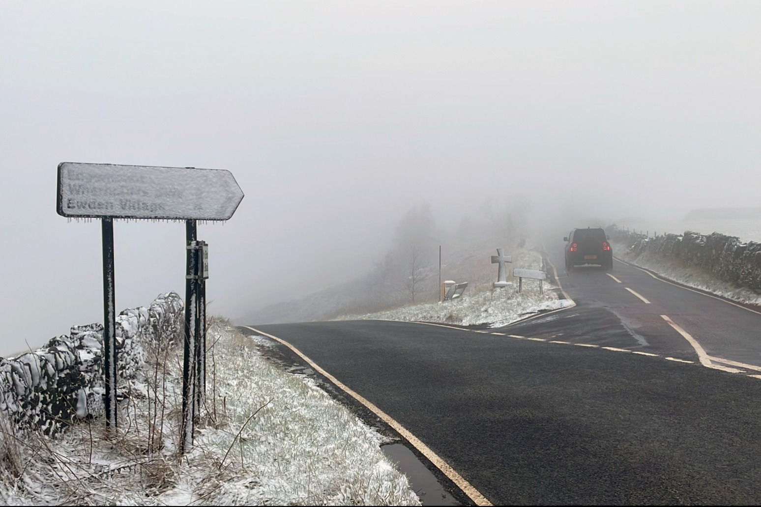
Rain and snow are expected to continue throughout the weekend before temperatures start to rise again next week.
Parts of East Anglia were hit with snow on Saturday, with 2cm in Norfolk and 1cm in Suffolk.
According to the Met Office, parts of the UK could continue to see snowfall throughout Sunday evening and into Monday.
Meteorologist Ellie Glaisyer said: “Over the weekend so far we’ve seen a couple of centimetres in the east.
“Going forward, we could see between 1cm and 3cm in parts of Scotland above 100m and the same in the north of the UK Monday into Tuesday.
“In the highest areas, above 300m, Scotland could see up to 20cm.”
But temperatures could rise to 13C or 14C by the middle of the week, with sunshine in a number of areas on Monday, Ms Glaisyer added.
It comes after much of the UK has seen “anticyclonic gloom” over the past week, causing dull skies, with some areas not having seen the sun in more than a week.
The predicted temperatures of 14C by the middle of the week are well above February’s average, with 6C the usual monthly average in Scotland and 9C in southern England, which will be a “noticeable shift” after the last fortnight which was below average, Met Office meteorologist Jonathan Vautrey previously said.
But it is not likely to be record-breaking, as February’s highest temperature was 21.2C recorded in 2019 in Kew Gardens, he added.
More western areas are likely to see some rain during the week, while eastern areas are forecast to stay drier.
Met Office meteorologist Tom Morgan said he does not expect any national records to be broken, but some areas could go 10 days without any sunshine, which is “near record-breaking”.
Mr Morgan said: “We’ve basically got this battleground taking place over this weekend between cold air across Scandinavia and central Europe, which is affecting eastern parts of the UK, but towards the west is a little bit milder.
“The Atlantic is trying to shift that cold air out of the way, pushing from west to east across the UK, but it’s a very slow process and it will take until the middle of the coming week for conditions to turn much milder nationwide.”
He explained the gloom “dominating” the UK over the last two weeks has been caused by a “large anticyclone”, or high-pressure system, which has been sitting over Scandinavia, bringing cold wind from the east.
“Those cold conditions have picked up a lot of moisture across the Baltic and North seas, and those moist conditions have led to a lot of clouds,” he added.
“That’s why we haven’t seen much in the way of sunshine in most of the UK recently.”
Published: by Radio NewsHub


Chart
-

1
Jonas Blue, Liam Payne And Lennon Stella
-

2
Tanja Thomas
-
3
The Monkees, 01.01
-
Top popular

Difficult day as last blast furnace shuts down at Port Talbot steelworks

UK Government charters flight for Britons in Lebanon

Household energy bills to rise for winter as Ofgem lifts price cap

Downton Abbey creator Julian Fellowes Dame Maggie Smith was blessing in my life

Ringleader of plot to smuggle 76m of cocaine into UK hidden in bananas jailed